
Why?
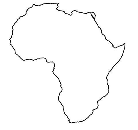
In high school I took a class whose teacher required us to memorize the location of every country in the world. At the time I found the task only vaguely interesting, for the most part simply a chore.
As I became more interested in understanding world news, cultural variations, and travelling, I realized there were dozens of countries existing whose locations and names I hadn't a clue! Harkening back to that high school class, I set out to memorize the location of every country on Earth. This post chronicles, by way of clarifying a few names that are easily mixed up, some interesting countries whose locations I learned.
Easy to Confuse
Burma, Benin, Burundi, Bahrain, Brunei, Bhutan, Beirut
Burma and Benin are listed first because I think they're the least likely to get confused with the other names on this list. Let's get them over with.
1. Burma (Myanmar)
Burma, now known as Myanmar, is probably the most well known country in this list. But in case you didn't know, it's in southeast Asia.
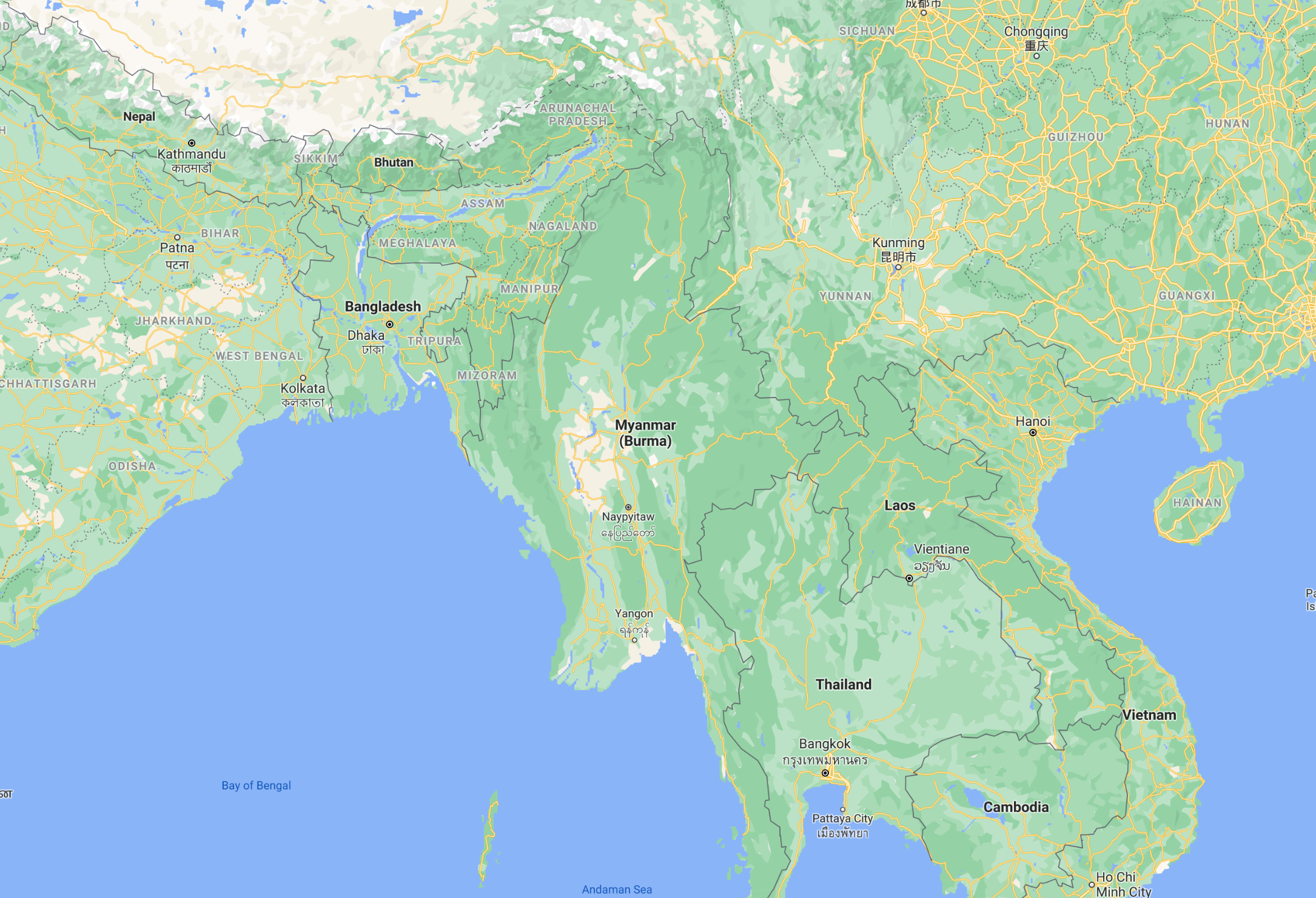
It's bordered by India and Bangladesh to the west, and it's important to remember here that India has a significant north-eastern component that extends its shape past the roughly diamond-shaped country that's easy to imagine without a map in front of you. The triangle-shaped area in between Bangladesh, Bhutan, and Myanmar is India.
The actual border shared between Myanmar and Bangladesh is actually quite small and begins at sea. To its east, Myanmar finds China, a short portion of Laos, and a long, narrow border with Thailand.
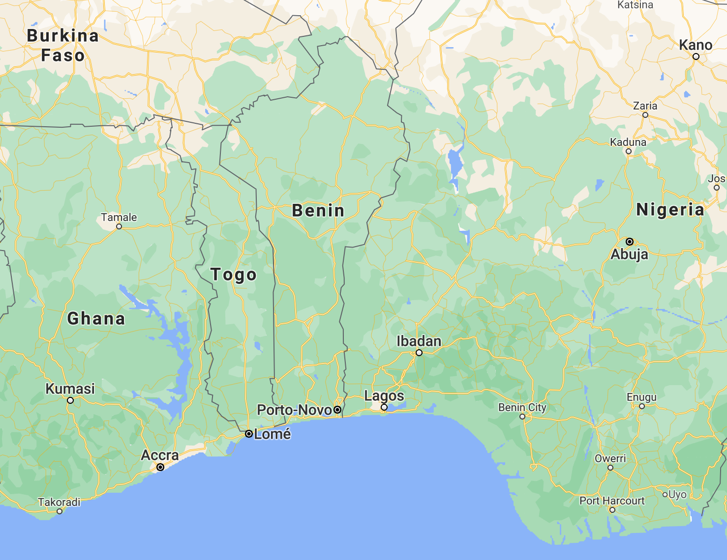
2. Benin
Benin is a skinny country in Africa just west of Nigeria, south of Burkina Faso and the southern tip of Niger.
If you really didn't pay attention in class: Niger and Nigeria are 2 different countries that border each other. Niger is landlocked, Nigeria has access to the sea. "Nigerians" are from Nigeria, "Nigeriens" are from Niger. Nigeria is more prominent in the world economy, has the highest population of any African country (#7 worldwide), and is generally seen in the news more frequently.
It's positioned right where the west coast of Africa begins to curve into its lower, narrower half. 0° N 0° W, also known as Null Island, is also near this area.
Locationally it's easily mixed up with Togo, another similarly shaped narrow country on its western border. Benin can be distinguished by its larger size and how its shape extrudes wider as it goes north. Sometimes I get them confused when quizzing myself, but after writing this article I probably won't forget anymore.
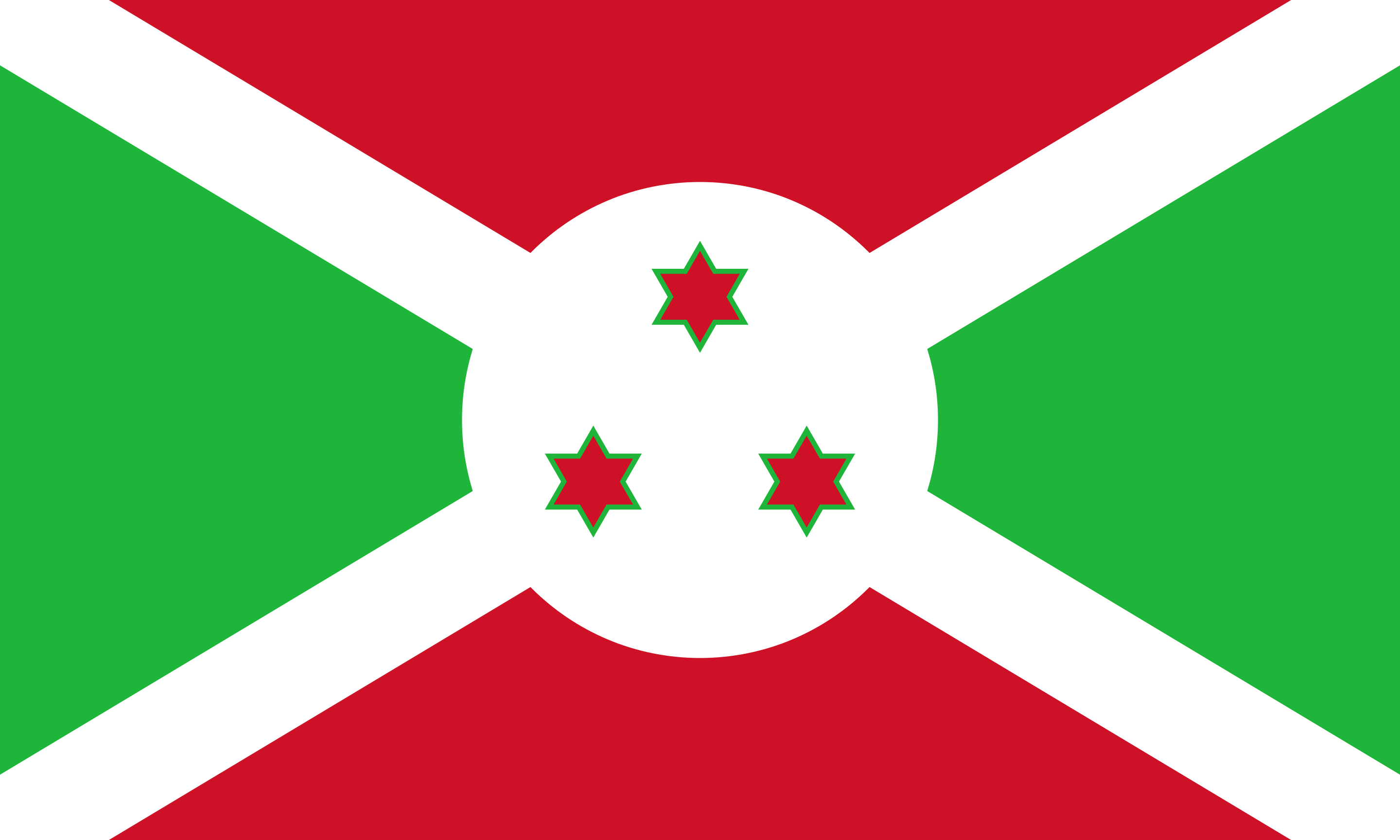
3. Burundi
Burundi is an African country that I didn't really know existed until intentionally learning where it is. I'm sure I've seen it in the daily world news occasionally, but I probably read through not knowing for sure if it was a country or a city.
I recently bought some coffee beans which were harvested in Burundi, and that might be the first time I can recall seeing the country referenced outside me specifically researching it. Burundi is a small country by African standards; it's approximately as big as its more well-known northern neighbor Rwanda. It borders DRC to the west and Tanzania to the east.
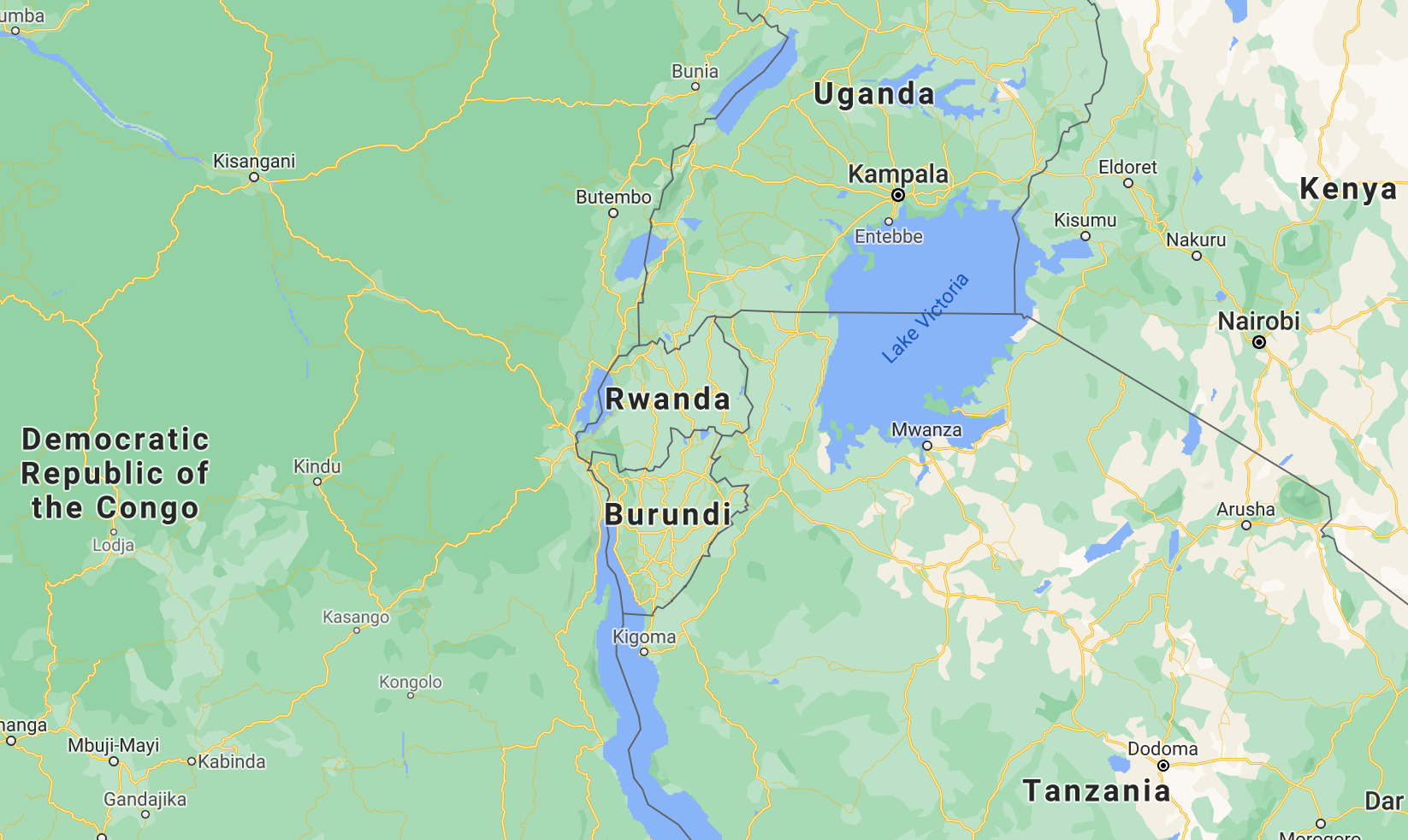
Unfortunately, Burundians (of which there are roughly 12 million) deal with a rather difficult life. In 2018 the country ranked as the world's least happy nation.
4. Bahrain
Bahrain is an island nation situated in the Arabian Gulf. It looks like you can drive to it from Saudi Arabia. If you're zoomed out on a map, it could be confused with Qatar, which is on a peninsula rather than an island.
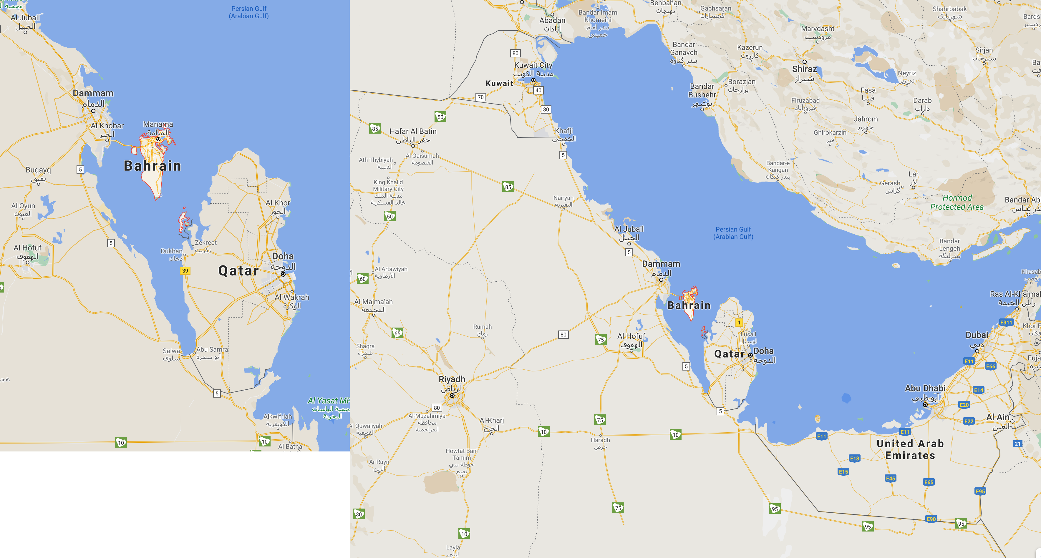
Bahrain enjoys a highly developed economy with advanced education and health care systems.
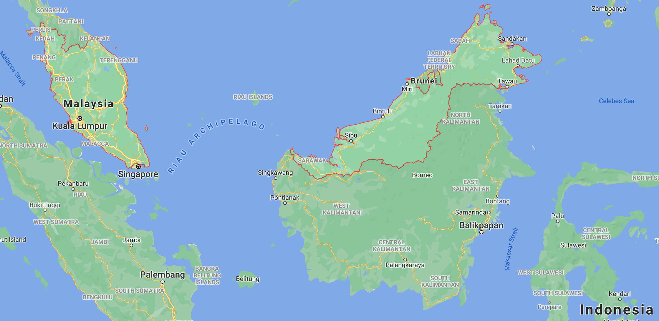
5. Brunei
Brunei is a small country in southeast Asia. It is located on the island of Borneo.
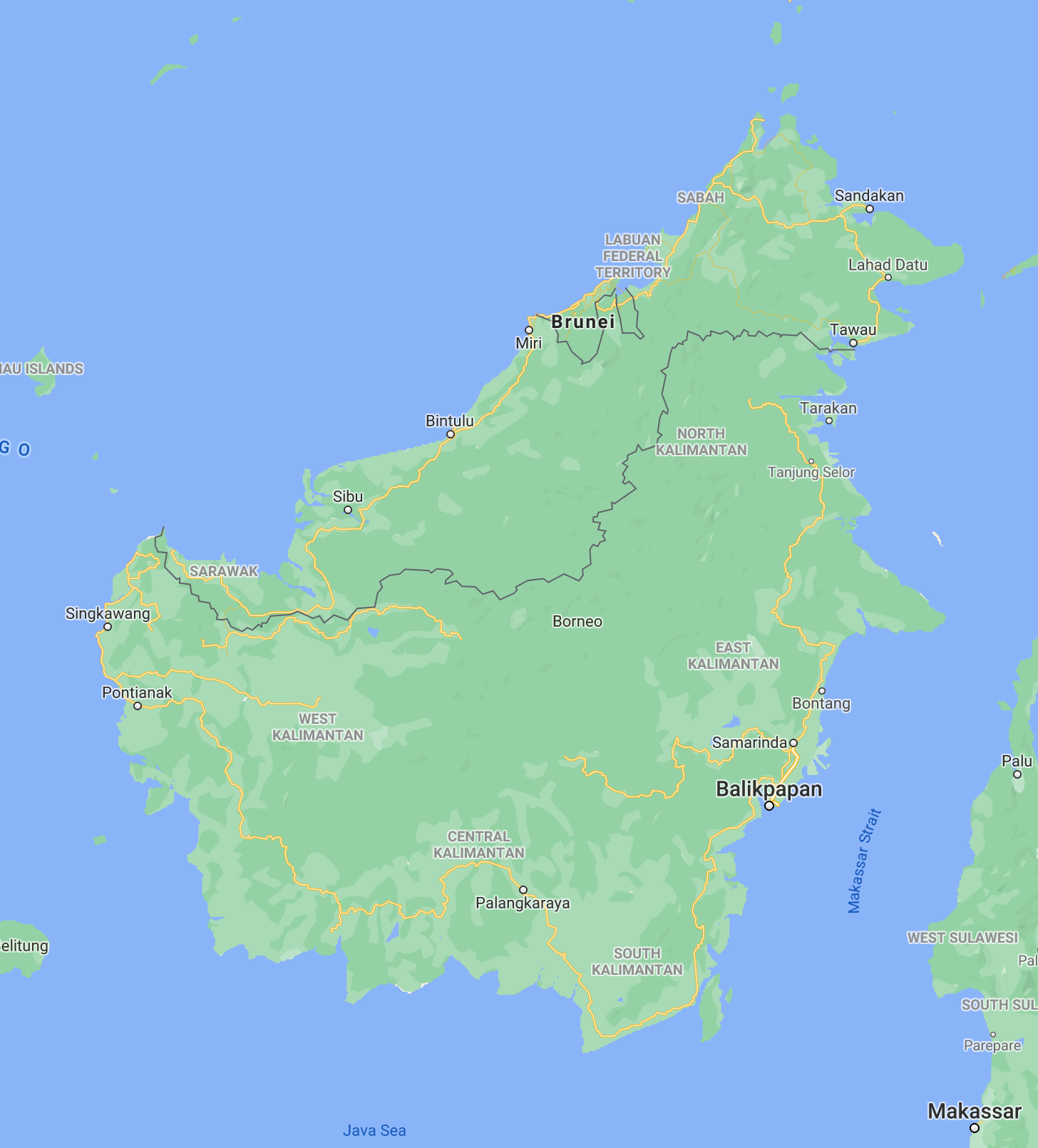
Borneo is an interesting island because by land mass it primarily houses part of Indonesia. As you go farther north up the island, you run into the largest single part of Malaysia, and finally, carved out of a small portion of its northern-facing coast, is Brunei. It's worth noting that the east portion of Brunei is actually not connected to the larger part by any natural land.
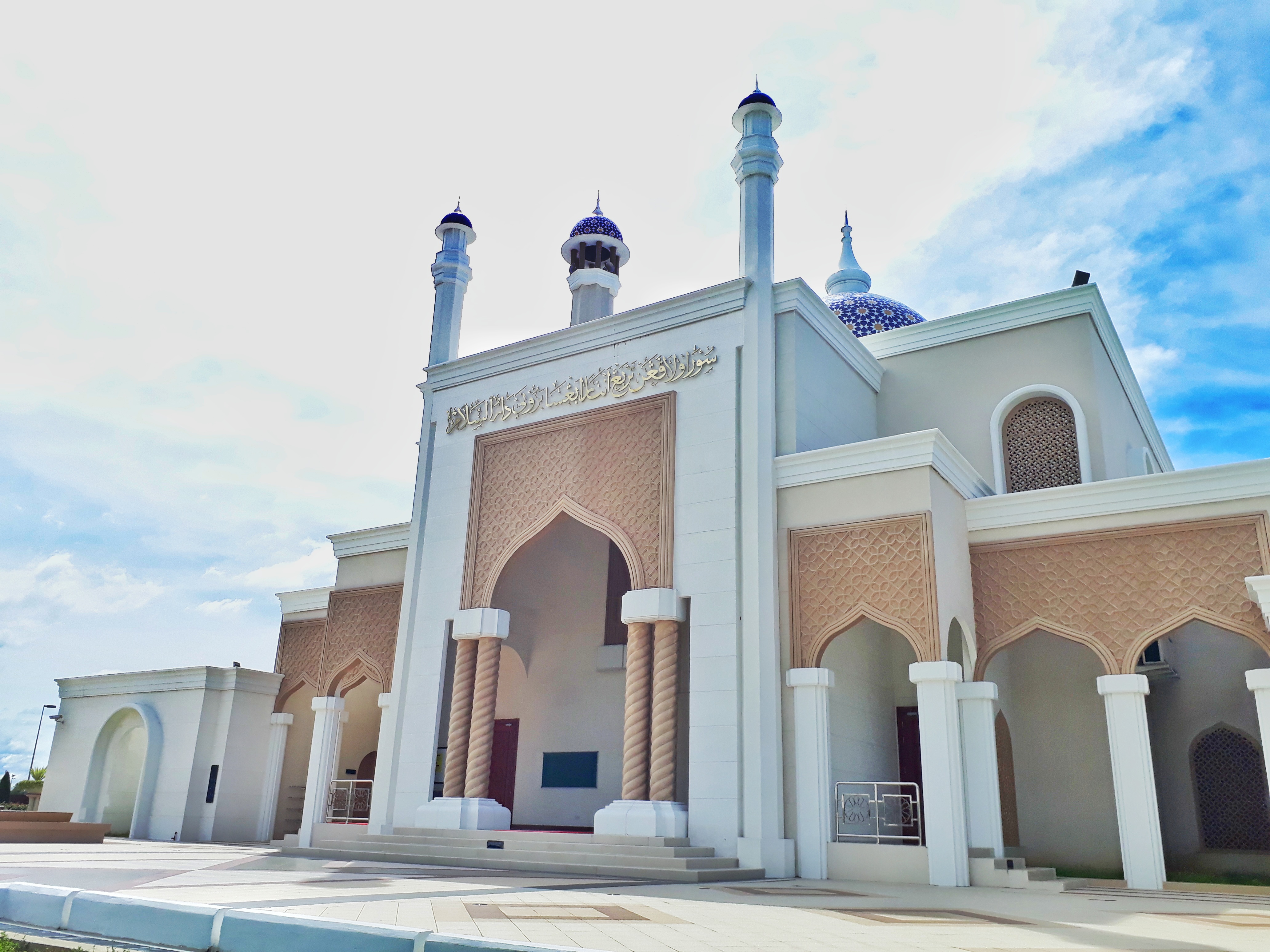
By Western standards, Brunei is a very traditional and strict country. Celebrating Christmas too much in public, for example, is illegal.
Personally, I'd like to visit and see some of their incredible mosques.
6. Bhutan
When I started quizzing myself on the locations of Asian countries, I often confused Bhutan and Nepal. It's easy to remember though: Nepal is more widely known and visited (it's where Mount Everest is), and it's larger than Bhutan and shares a much larger border with India.
Bhutan and Nepal are both only bordered by India and China, even though they are both pretty close to Bangladesh and are both in the Himalayas (which serve as a natural border between them, India, and China).
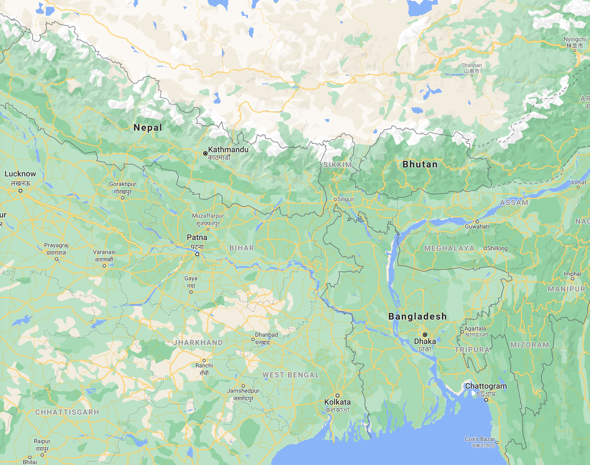
Bhutan's currency has a distinctive name: the ngultrum. It is also a somewhat difficult country to visit if you do not have a lot of currency (of any sort). Unless you hold a passport from Bangladesh, Maldives, or India, you'll need to apply for a visa and pay a charge of roughly USD$200 per day that you reside there.
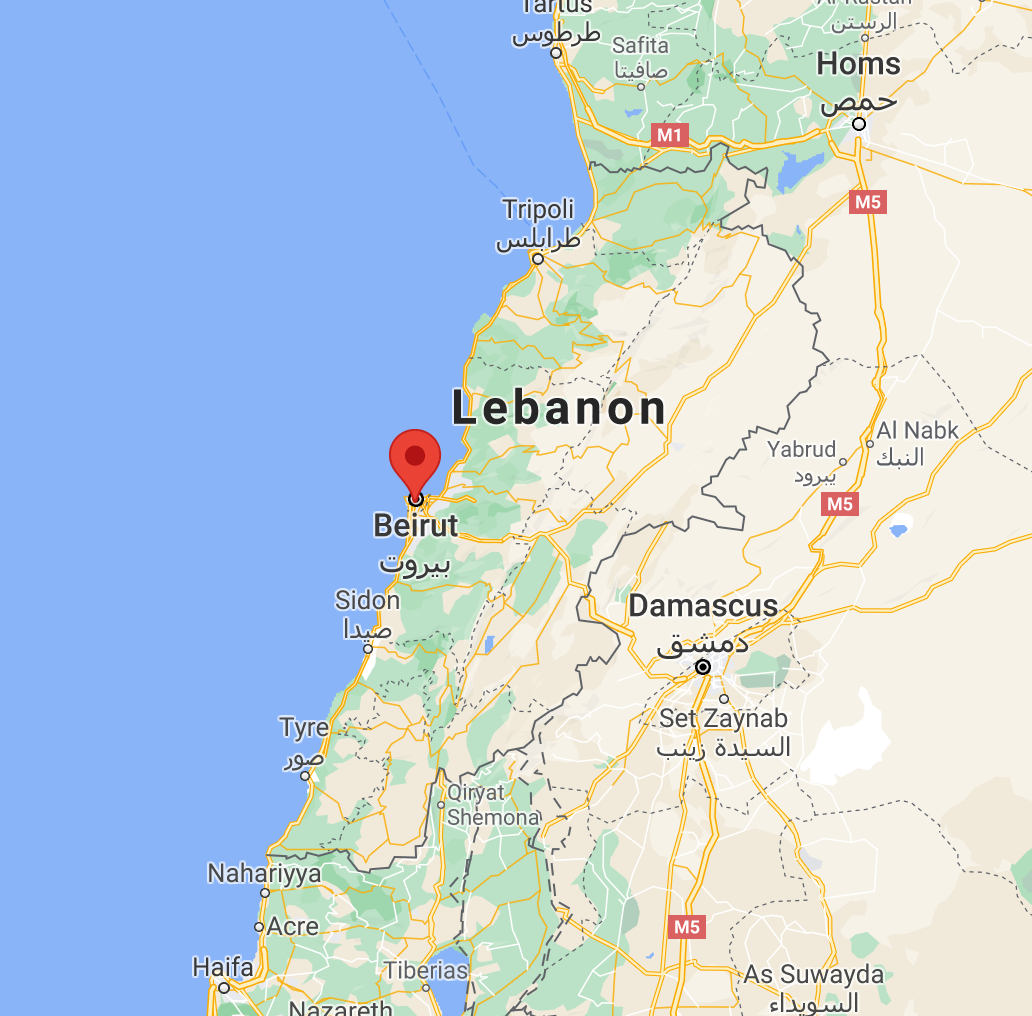
7. Beirut
This one is not like the others, as it is a city, but I included it because as the capital of Lebanon, it is seen in news fairly frequently, and it's another "B" name I could add to the list.
Next Up!
I hope this helps you remember each of these countries.
Next up: Papa New Guinea, Guinea, Guinea-Bissau, Equatorial Guinea, French Guiana, Guyana